Disruptive winds and rainstorms set to hit Derbyshire


According to the Met Office the severe weather will hit on Tuesday night.
The low-pressure vortex is currently ripping up the Atlantic ocean bringing the washout weather.
Advertisement
Hide AdAdvertisement
Hide AdJohn Hammond Met Office forecaster said: “This week, a huge vortex of low pressure in the eastern Atlantic will see the jet stream fling a succession of wet and windy spells towards UK.
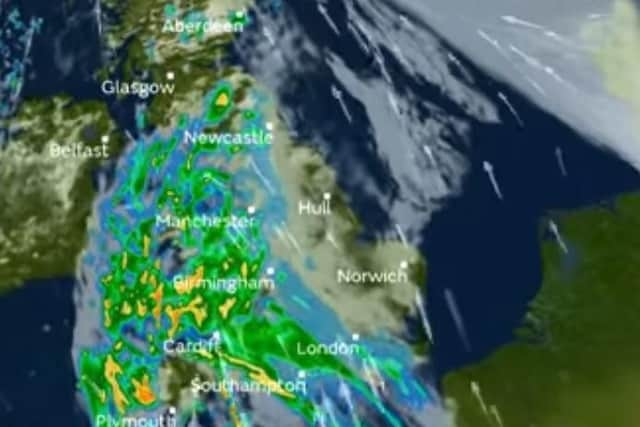
“The potential for disruptive winds needs to be watched. Western parts are most prone. Several wet spells are expected.
“Winds pick up again from later Tuesday, with 40mph gusts and remaining windy with the strongest winds likely in the South through the rest of the working week and possibly into the weekend, with low pressure dominating.”
Alex Deakin a Meteorologist for the Met Office said today that while there will be rain temperatures will still remain in their teens.
He said: "Once the rain has arrived here it could be pretty heavy.
“It will last well into Wednesday.
“It could use a few problems as the winds start to pick up still bringing mild air.”